
Chisapani–Nagarkot trek: a two-night walk from Kathmandu
A short trek that starts on the edge of Kathmandu: up stone steps through the forest of Shivapuri Nagarjun National Park to Chisapani, then along village paths to the hill station of Nagarkot for a Himalayan sunrise. No altitude to worry about and no technical sections, just two full days on the paths villagers walk every day. Here is what to expect, from the park fee to the monkeys.
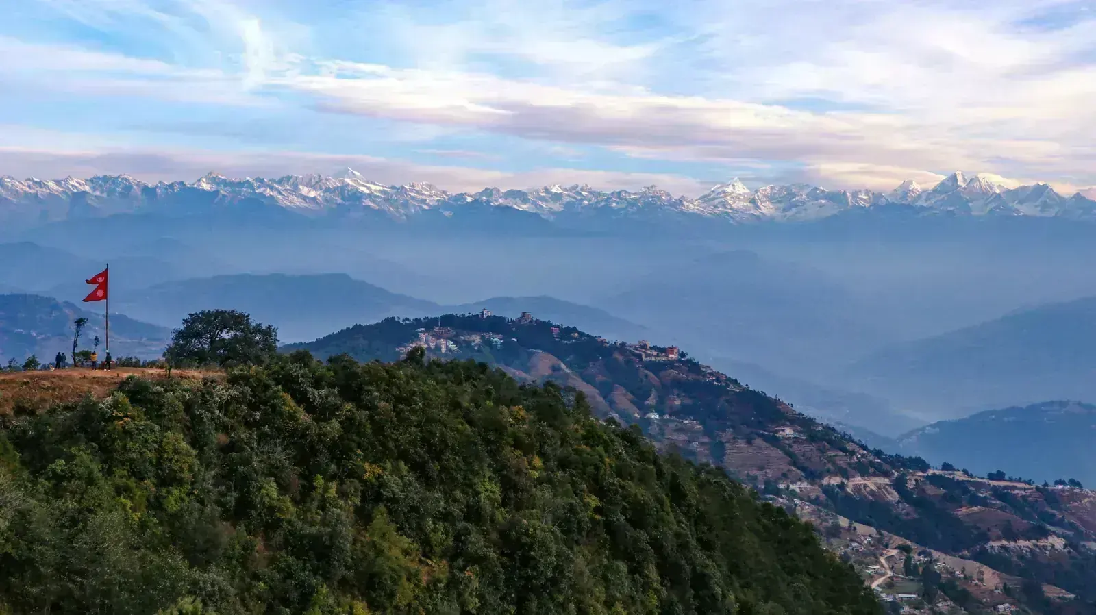
- High point
- 2,430 m · Borlang Bhanjyang
- Duration
- 2–3 days
- Best months
- Feb–Apr, Oct–Dec
- Difficulty
- Easy, non-technical
- Guide
- Not required
For guidance only. Check details with your operator and the official sources listed at the end before you book.
Where to book and compare Chisapani–Nagarkot trips
Booking sites · affiliate linksEach site lists trips from several operators. Compare dates, group sizes, what is included and reviews there; we don't rank operators.
We earn a commission if you book through these links, at no extra cost to you. Prices and availability are on each site.
On this page
Which route should you choose?
Every version starts at Sundarijal, about 15 km north-east of central Kathmandu, and spends the first night in Chisapani and the second in Nagarkot. They differ only on day 3: back to Kathmandu by car, a downhill walk to Changu Narayan, or a longer day on to Dhulikhel.
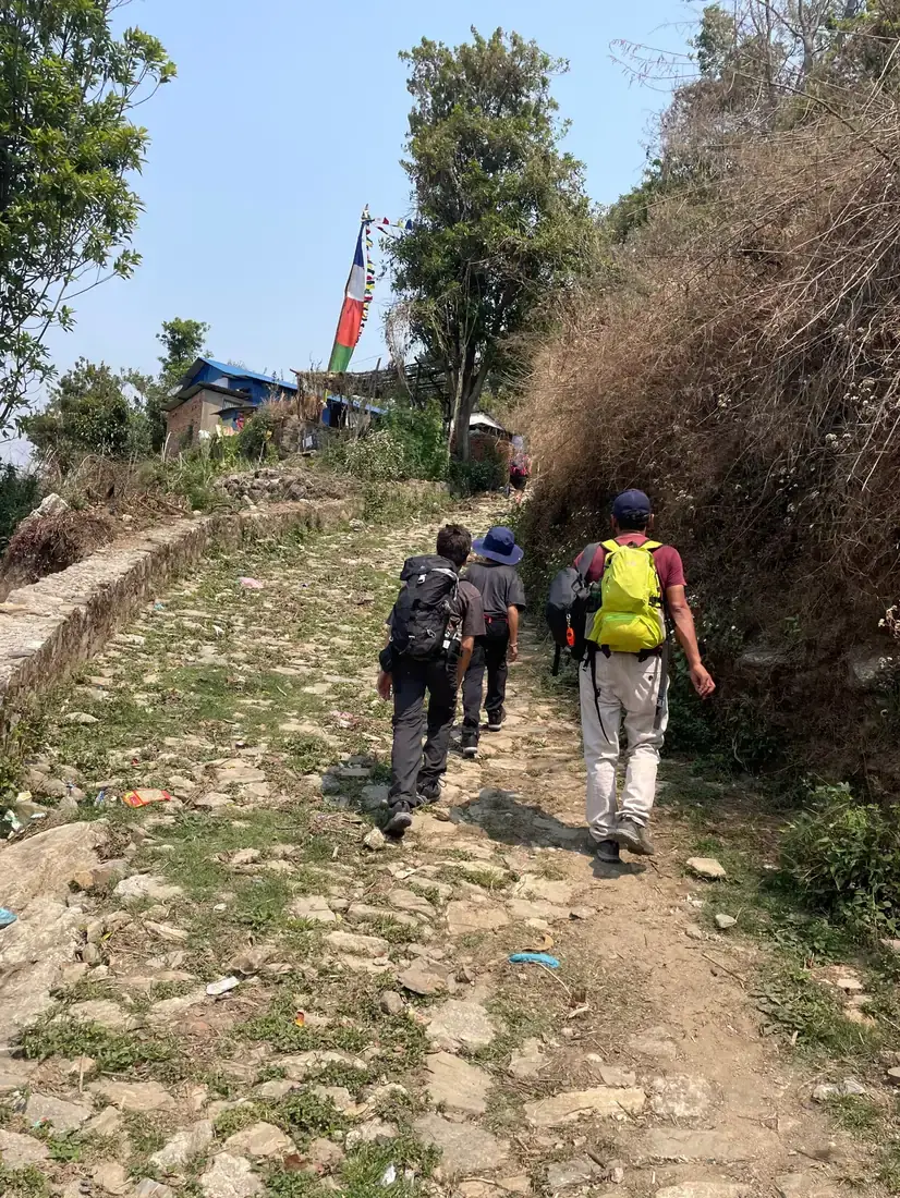
This is not a wilderness trail. Much of it is the everyday path villagers use to walk from one village to the next, with stone steps, cobbles, farm terraces and, on day 2, some stretches of dirt road shared with the odd jeep or motorbike.
| Route | Days | Scenery | Crowds | Acclimatisation |
|---|---|---|---|---|
| Sundarijal–Nagarkot itinerary belowThe classic two nights. Day 3 is the Nagarkot sunrise and the drive back. | 3 | Very good | Medium | Very good |
| Changu Narayan extensionA downhill morning walk to a temple on the UNESCO World Heritage list, then a short drive to Kathmandu. | 3 | Excellent | Medium | Very good |
| Dhulikhel extensionA longer day 3 along the rim of the valley to the town of Dhulikhel, with quieter paths. | 3–4 | Excellent | Low | Very good |
3-day Sundarijal–Nagarkot itinerary at a glance
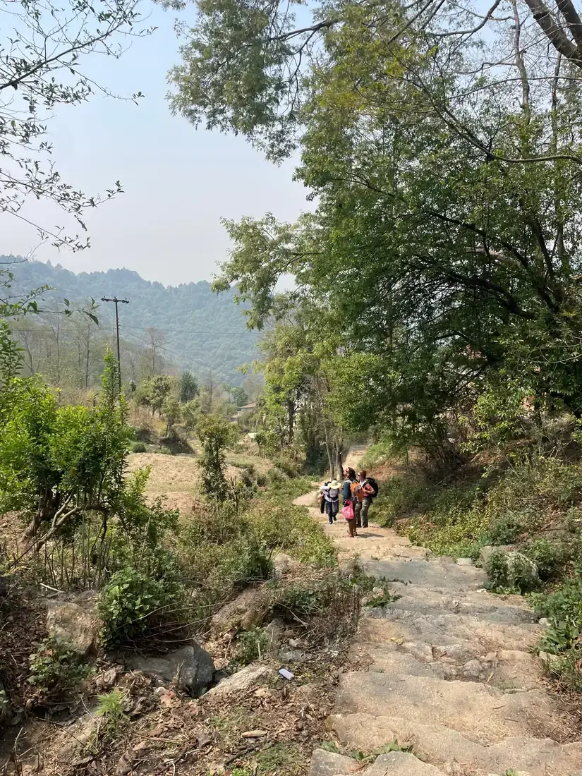
Day 1 is the climb: from Sundarijal up long flights of stone steps past the reservoir and the army checkpoint, where you pay the park fee, then through Mulkharka and the forest to the ridge at Borlang Bhanjyang, and down to Chisapani. Count 4–6 hours for roughly 12 km to 15 km.
Day 2 is longer but easier on the legs: down from Chisapani through farming villages to Chauki Bhanjyang and Jhule, then along the ridge to Nagarkot, 6–8 hours. Day 3 starts with the sunrise over the Himalaya from Nagarkot; we drove back to Kathmandu after breakfast.
- Day 1 Sundarijal Chisapani via Borlang Bhanjyang 2,430 mnight at 2,200 m
- Day 2 Nagarkot night at 2,175 m
- Day 3 Kathmandu (by car) night at 1,400 m
What it really costs
A short trek with few fixed costs. Package prices vary with group size, hotel level in Nagarkot and what is included, so compare them on the booking sites; these are the costs to plan around.
Insurance that covers Chisapani–Nagarkot
The route stays below 2,500 m, so a standard travel policy that covers hiking is usually enough; you don't need high-altitude cover. Check that yours includes trekking on foot and medical treatment and evacuation in Nepal.
Keep your policy number and the insurer's emergency line on your phone and on paper. Kathmandu's hospitals are a short drive from every point on the route.
Staying connected in Nepal
Nepal's two mobile networks are Nepal Telecom (NTC) and Ncell. An eSIM installed before you fly works as soon as you land at Kathmandu airport; local SIM cards are sold at the airport and in town with your passport and a photo.
Villages along the route usually have signal, and parts of the forest on day 1 don't. Download an offline map before you set off: the village paths on day 2 split often.
Getting there and where to stay
Fly into Tribhuvan International Airport (KTM) in Kathmandu. The trek starts at Sundarijal, about an hour's drive from the centre depending on traffic, and ends at Nagarkot, about 32 km from Kathmandu by road.
Getting there by air
A night in Kathmandu either side
Kathmandu to Sundarijal
Gear: rent or buy
No special gear: this is a long walk, not a mountain climb. What matters most is shoes with good grip for the stone steps, which are slippery when wet, and a bag that closes properly, because of the monkeys.
- Walking shoes or light boots with good grip, broken inBuy
- Daypack of 20–30 litres that zips shutRent or buy
- Water bottle and purification tablets or filterBuy
- Rain jacket, especially in spring and autumn showersRent or buy
- Warm layer for the evenings in ChisapaniRent or buy
- Sun hat and sunscreenBuy
- Headlamp for early sunrise walks and power cutsBuy
- Trekking poles for the long descentsRent or buy
Add a few days in Nepal
Kathmandu Valley has seven monument zones on the UNESCO World Heritage list, all within an hour or so of the trail's end.
Bhaktapur Durbar Square
Changu Narayan Temple
Boudhanath Stupa
Frequently asked questions
How hard is the Chisapani–Nagarkot trek?
It is a trek for almost everybody who walks regularly. Day 1 climbs about 1,000 m on stone steps and forest paths in 4–6 hours; day 2 is longer, 6–8 hours, but mostly gentle, on village paths and some dirt road. There are no technical sections, and families with older children walk it.
Do I need a permit or a guide?
You pay the Shivapuri Nagarjun National Park entry fee at the checkpoint above Sundarijal. You don't need a TIMS card. Nepal's 2023 rule requiring a licensed guide applies to the trekking routes that need a TIMS card, and many walkers do this route on their own, but rules in Nepal change: check the current rule with the Nepal Tourism Board or your operator before you go. A local guide also helps on day 2, where the village paths split often.
What about food, dietary needs and faith on the trek?
Lodges in Chisapani mostly serve dal bhat (rice, lentils and vegetables), noodles, eggs and bread, so eating vegetarian is easy. Meat on the trail is usually not halal. If you need halal or vegan food or have an allergy, tell your operator before booking and ask what the lodges can cook, or choose vegetarian meals. Kosher food is not something to expect on the trail; bring your own if you need it. Kathmandu has halal restaurants for the nights before and after.
If you pray during the day, agree stops with your guide in advance. There are no mosques on the route; Kathmandu has mosques. Anything you need for your practice, such as a light prayer mat or a qibla app, fits easily in your daypack.
Which languages do guides speak?
Most guides speak English and Nepali. If you need another language, such as Arabic, French or Spanish, ask operators before booking whether they can assign a guide who speaks it. A private trek gives you the most say in who walks with you.
Should I tip the guide and porter?
Tipping guides and porters at the end of a trek is customary in Nepal and a real part of their income. Ask your operator what is usual for a trek of this length, and tip in cash, in rupees.
Which visa do I need?
It depends on your passport: check the current rules with Nepal's Department of Immigration before you fly. A tourist visa on arrival at Kathmandu airport costs $30 for 15 days, $50 for 30 days or $125 for 90 days. Citizens of Saudi Arabia, the UAE, Qatar, Kuwait, Bahrain and Oman, for example, can get one. You can fill in the arrival form online before you fly to save time at the airport.
Are there monkeys or other wild animals?
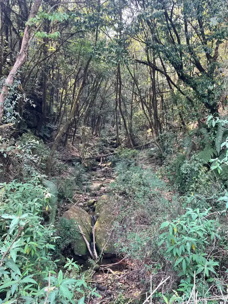
Yes. Rhesus monkeys live in Shivapuri Nagarjun National Park, and on our April trek a troop surrounded us in the forest and helped themselves to our biscuits. Keep food zipped inside your bag, don't eat in front of them and never feed them. Leopards and Himalayan black bears also live in the park but are very rarely seen by walkers.
Will I see Everest?
On a clear morning Nagarkot looks out over several Himalayan ranges, from Annapurna and Langtang in the west to the Everest range in the east, where Everest itself is a small far-off point. The clearest views are from October to December. In spring the air is often hazy, as it was on our April trek, so the forest and rhododendrons are the show rather than the peaks.
Can I get altitude sickness on this trek?
It is unlikely. You sleep at about 2,200 m in Chisapani and Nagarkot, and the risk of altitude sickness mostly starts when you sleep above about 2,500 m. Tell your guide if you feel unwell all the same.
When is the best time to go?
February to April and October to December. Autumn brings the clearest mountain views; spring brings rhododendron flowers and warmer days with more haze. The monsoon, from June to September, makes the trail muddy, brings leeches and usually hides the mountains.
Sources and last check
- Department of National Parks and Wildlife Conservation: Shivapuri Nagarjun National Park
- The Longest Way Home: national park entry fees in Nepal (updated January 2026)
- Wikipedia: Shivapuri Nagarjun National Park
- Wikipedia: Nagarkot
- Wikipedia: Visa policy of Nepal
- Much Better Adventures: Nepal's 2023 licensed-guide rule
- Wonder Hikes Nepal: Chisapani–Nagarkot distances and permits (June 2026)
- CDC Yellow Book: high-altitude travel and altitude illness
Image credits
- Photo: Ghana Shyam Khadka / Unsplash · Unsplash License
- Photo: Pascal / HoyooTrek
- Photo: Pascal / HoyooTrek
- Photo: Pascal / HoyooTrek