
Crater Highlands trek: from Empakaai Crater to Lake Natron in two to five days
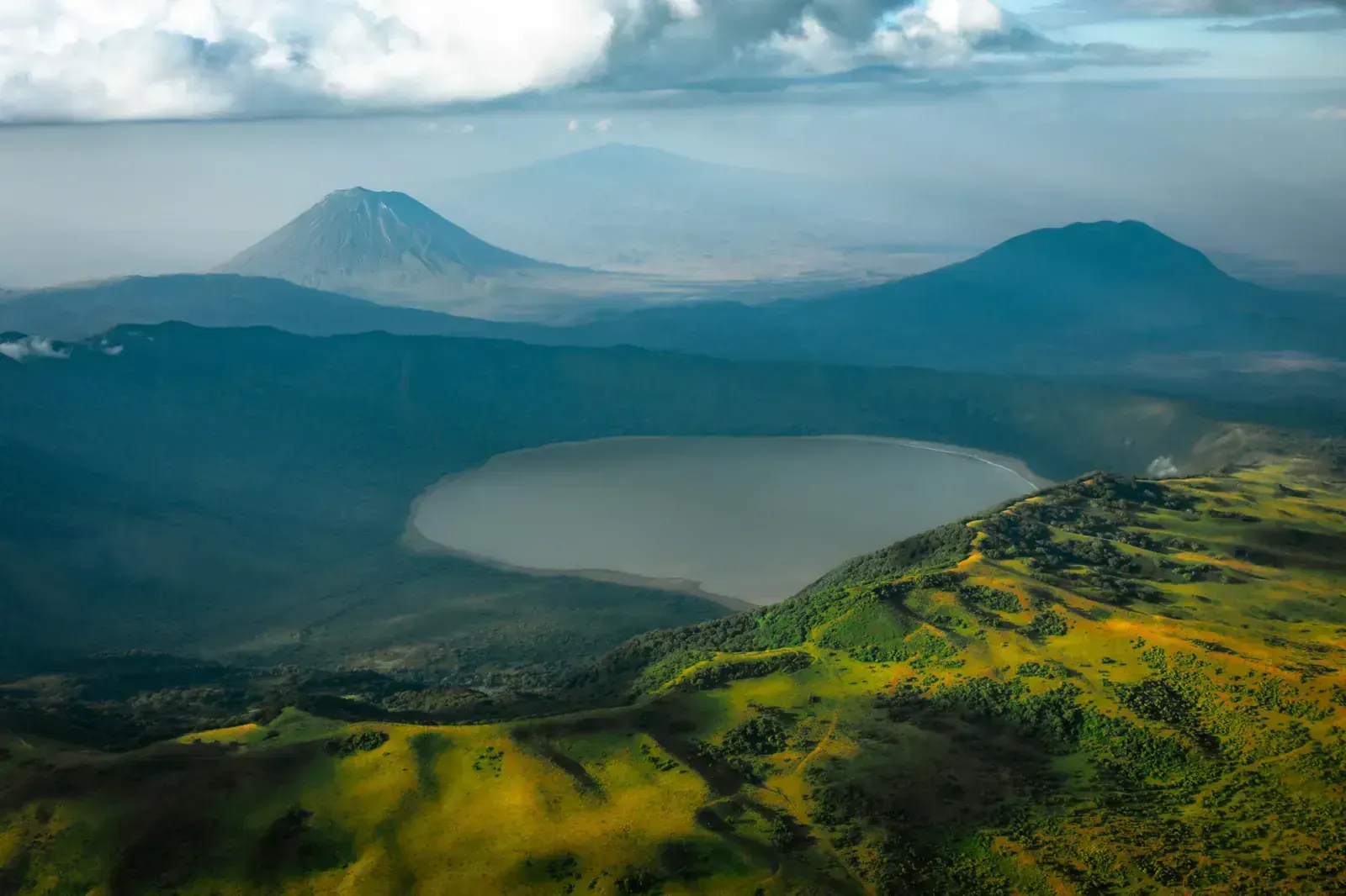
North of the Ngorongoro Crater, a string of old volcanoes rises over Maasai grazing land. A walking route crosses them: from Nainokanoka past Olmoti Crater (3,080 m) to the rim of Empakaai Crater, about 3,200 m on its western side, then down the Great Rift escarpment to Lake Natron, about 600 m. It takes 2–5 days, camping each night, with an armed ranger from the conservation authority, a local guide and, on most trips, donkeys carrying the bags. The highland nights are cold; the last day ends in the heat of the Rift floor, below the active volcano Ol Doinyo Lengai. Here is what to expect, as of November 2026.
- High point
- 3,200 m · Empakaai Crater rim
- Duration
- 2–5 days
- Best months
- Jun–Oct
- Difficulty
- Moderate, non-technical
- Guide
- Required by park rules
For guidance only. Check details with your operator and the official sources listed at the end before you book.
Where to book and compare Crater Highlands trek: Empakaai to Lake Natron trips
Booking sites · affiliate linksEach site lists trips from several operators. Compare dates, group sizes, what is included and reviews there; we don't rank operators.
We earn a commission if you book through these links, at no extra cost to you. Prices and availability are on each site.
On this page
Which route should you choose?
The Crater Highlands are a chain of volcanoes in the Ngorongoro Conservation Area, Maasai land where people live with their cattle. The conservation authority allows multi-day walks only in designated areas, never inside the Ngorongoro Crater itself, and every walking group must be accompanied by an armed ranger booked in advance. Camping is only allowed at designated sites, and special campsites must be reserved.
The classic crossing runs north: from the village of Nainokanoka, near Olmoti Crater (3,080 m), across the Embulbul depression to Empakaai. Empakaai's rim is about 3,200 m on the west side and 2,590 m on the east, according to the authority, and a steep path leads down to its soda lake. From there the route passes Maasai villages and drops down the Great Rift escarpment to the hot plain around Lake Natron (about 600 m). The options below differ in where you start and whether you add Ol Doinyo Lengai.
| Route | Days | Scenery | Crowds | Acclimatisation |
|---|---|---|---|---|
| Nainokanoka to Lake Natron in 4 days itinerary belowThe usual crossing: Embulbul depression, the Empakaai rim with a walk down to the crater lake, Maasai villages, then the escarpment to Natron. An afternoon walk to Olmoti can be added before day 1. | 4 | Excellent | Low | Good |
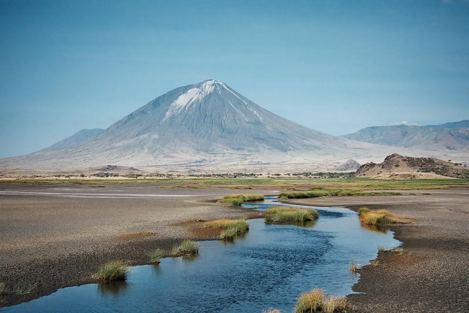
| Highlands plus Ol Doinyo Lengai, 5 daysAdds a night climb of Ol Doinyo Lengai from the Natron side: a steep ascent of about 6 hours on ash and loose rock. Lengai is an active volcano; check its status locally before you book. | 5 | Excellent | Low | Good |
| Empakaai to Natron, 2 daysStarts by vehicle at Empakaai and walks only the second half to Natron, with one night in a tent. Less time on the highlands. | 2 | Very good | Low | Weaker |
4-day Nainokanoka to Lake Natron in 4 days itinerary at a glance
A common 4-day programme, from operator itineraries. Day 1, Nainokanoka to Bulati, about 15 km in 4 to 5 hours across the Embulbul depression. Day 2, Bulati to the Empakaai rim, about 12 km in 3 to 4 hours, then an afternoon walk down to the crater lake with your ranger: the authority says it takes about an hour down and two and a half hours back up. Day 3, Empakaai to Acacia camp via Naiyobi, about 15 km, with donkeys carrying the bags. Day 4 descends the escarpment towards Ol Doinyo Lengai: 5 to 7 hours, steep, loose and hot, often finished by vehicle to a camp near Engaresero and Lake Natron.
- Day 1 Nainokanoka Bulati
- Day 2 Bulati Empakaai Crater rim
- Day 3 Empakaai, via Naiyobi Acacia camp
- Day 4 Acacia camp, down the Rift escarpment Lake Natron (Engaresero)
What it really costs
Almost everyone walks on a package with the ranger, guide, donkeys, crew, permits and the vehicle at both ends. Fees on this trek are paid to two bodies, the conservation authority and the Natron villages, so ask for a clear breakdown.
Insurance that covers Crater Highlands trek: Empakaai to Lake Natron
Since 1 October 2026, every foreign visitor entering mainland Tanzania must buy the government's inbound travel insurance from NIC ($44, up to 92 days). It covers emergency medical care, evacuation and repatriation within its limits; keep your own trekking policy too, and check it covers remote evacuation and a volcano climb if you add Ol Doinyo Lengai.
Emergency number in Tanzania: 112. Mobile signal is patchy on the highlands, so agree with your operator how the crew calls for help. Check the official travel advice before you go, for example from the UK FCDO.
Staying connected in Tanzania
Ask your eSIM provider about coverage in Tanzania before you fly, or buy a local SIM in Arusha with your passport (registration is required). We found no reliable report on coverage in the highlands or at Natron, so plan for long gaps and bring a power bank.
Getting there and where to stay
Fly into Kilimanjaro International Airport (JRO), about 50 km from Arusha. Operators drive walkers from Arusha up to the Ngorongoro highlands for the start, and back from Lake Natron at the end: about two and a half hours from Natron to Mto wa Mbu, then about two and a half hours to Arusha.
Getting there by air
Nights in Arusha
The drive back from Natron
Gear: rent or buy
Two climates in one trek. Highland nights are cold: monthly lows on the Ngorongoro Crater rim, about 2,300 m, average 8 °C to 11 °C, the rim can freeze in the dry season, and the trek's high points, Olmoti and the Empakaai rim at about 3,200 m, are higher still. Lake Natron is often above 40 °C, and the escarpment descent has little shade. Donkeys carry your bag; you carry a daypack and plenty of water.
- Sleeping bag for near-freezing nights on the rimRent or buy
- Warm jacket, hat and glovesRent or buy
- Broken-in boots with grip for loose ashBuy
- Trekking poles for the escarpmentRent or buy
- Sun hat, sunglasses and high-factor sunscreenBuy
- Water bottles or a bladder holding 3 litres or moreBuy
- Headlamp, and a buff against dustBuy
- Gaiters for ash and sandRent
Add a few days in Tanzania
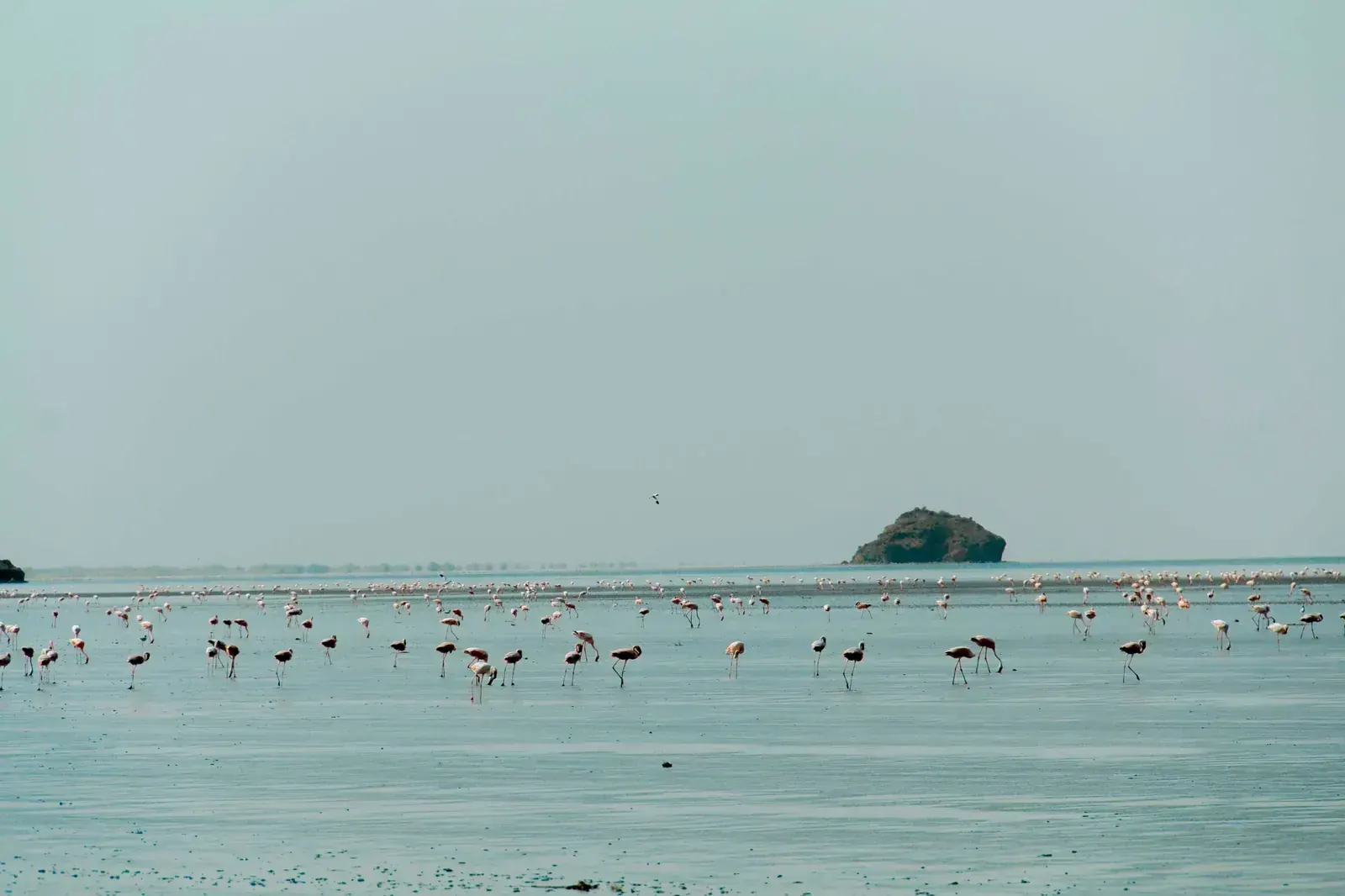
The trek ends in one of the strangest landscapes in East Africa, so leave time at Natron.
Ol Doinyo Lengai
Lake Natron flamingos
Engare Sero footprints and waterfall
Frequently asked questions
How hard is the Crater Highlands trek?
Moderate. The highland days are 3 to 5 hours on paths and tracks at altitudes up to about 3,200 m. The last day is the hard one: a long, steep descent of the Rift escarpment on loose ash, in strong heat. Adding Ol Doinyo Lengai makes it much harder.
Do I need a ranger or a guide?
Yes. The Ngorongoro Conservation Area Authority requires an armed ranger, booked in advance, for every walk in the area. Operators add a local Maasai guide. Walks are allowed only in designated areas, and you camp only at designated sites.
Where do I sleep?
In tents at campsites set up by your crew; special campsites in the conservation area must be reserved in advance. Some campsites have no facilities, so ask your operator about toilets and washing water.
What about food, dietary needs and faith on the trek?
Your crew cooks in camp. Ask your operator before booking where the food is bought and whether the meat will be halal, or ask for vegetarian meals. Tell them too about any vegan diet, allergy or other need. Kosher food is not something to expect on this trek; bring your own if you need it.
If you pray or keep another religious practice, ask how the walking times fit around it. Water is scarce on the escarpment day, so ask how much the donkeys will carry, including water for wudu if you need it. On a Lengai climb, if you pray Fajr, agree a short stop with your guide. Ramadan 2027 is expected to start around 8 February 2027; the Natron day is very hot, so if you fast, plan it with your operator.
Can I take photos of the Maasai?
The conservation authority's visitor rules prohibit photographing local people except at designated cultural bomas. Ask your guide before you take any photo of people or their homes, and respect a no.
Which visa and insurance do I need?
It depends on your passport: check the current rules on the official Tanzania immigration website before you book. The ordinary Tanzania visa costs $50 (single entry), by eVisa or on arrival; citizens of Saudi Arabia, the UAE, Qatar, Kuwait, Bahrain and Oman, for example, need it. Since 1 October 2026 foreign visitors must also buy the NIC inbound travel insurance ($44) before entry. A stop of 12 hours or more in Kenya or Ethiopia also means a yellow fever certificate.
Is it safe to climb Ol Doinyo Lengai?
Lengai is an active volcano: researchers measured the ground rising in 2022 and 2023, and lava overflowed in its crater in May 2025. We found no official closure or advisory for 2026, and no authority that publishes the climbing status. Ask your operator and local guides about current activity, and be ready to skip it.
What about the Maasai relocations in Ngorongoro?
Since 2022 the government has moved Maasai residents out of the conservation area, which it describes as voluntary and necessary to protect the area; Human Rights Watch said in 2024 that the plan aims to move more than 82,000 people and called the relocations forced. Two presidential commissions reported in March 2026; their reports were not public when we checked. We found no change to visitor access for this trek. Ask your operator how fees and jobs reach the communities you walk through.
When should I go?
June to October is the main dry season; January and February can be drier, but the conservation authority counts November to April as its rainy season.
Which languages do guides speak?
Expect Swahili, Tanzania's national language; we found no source on which other languages the guides and rangers on this walk speak. Before you book, ask your operator whether your guide speaks English, or another language you need, such as Arabic, French or Spanish.
Sources and last check
- NCAA: visitor guidelines and procedures, armed ranger for walks, campsites, photography (checked 6 Nov 2026)
- NCAA: tourism activities, walking areas and multi-day walks (checked 6 Nov 2026)
- NCAA: frequently asked questions, walks only in designated areas (checked 6 Nov 2026)
- NCAA: Empakaai Crater, rim altitudes and crater walk (checked 6 Nov 2026)
- NCAA: Olmoti Crater, 3,080 m (checked 6 Nov 2026)
- Wikipedia: Lake Natron, altitude, flamingos (checked 6 Nov 2026)
- Wikipedia: Ol Doinyo Lengai, altitude and carbonatite lava (checked 6 Nov 2026)
- Smithsonian Global Volcanism Program: Ol Doinyo Lengai (checked 6 Nov 2026)
- Live Science: Ol Doinyo Lengai is bulging, study of 2022–23 uplift (13 Sep 2024)
- Vulkane.net: lava overflow in Lengai's crater, May 2025
- Scientific Reports: Engare Sero footprints (14 May 2020)
- Africa Geographic: Lake Natron, flamingo season, Lengai climb (checked 6 Nov 2026)
- Roadtrip Africa: Lake Natron fees paid at Engaresero, road times to Mto wa Mbu (checked 6 Nov 2026)
- Walkopedia: Empakaai toward Natron, the escarpment descent (checked 6 Nov 2026)
- Highlands itinerary, stages and distances (operator, checklist only)
- Highlands itinerary, daily walking hours (operator, checklist only)
- Climate of the Ngorongoro highlands (checked 6 Nov 2026)
- SafariBookings: Ngorongoro climate, frost on the rim in the dry season (checked 6 Nov 2026)
- Human Rights Watch: Maasai relocation in Ngorongoro (31 Jul 2024)
- Down to Earth: presidential commissions on Ngorongoro report, March 2026
- Short Empakaai to Natron walk, 2 days (operator, checklist only)
- The Citizen: government says relocations protect Ngorongoro
- Tanzania Immigration: visa guidelines (checked 6 Nov 2026)
- Embassy of Norway in Tanzania: mandatory inbound travel insurance from 1 October 2026
- ATTA: inbound travel insurance prices and validity (29 Sep 2026)
- Ministry of Health: yellow fever entry requirement, 31 Jul 2023
- UK FCDO Tanzania travel advice, emergency number 112 (updated 30 Oct 2026)
- Tanzania Meteorological Authority short-rains outlook 2026, via Daily News (21 Sep 2026)
- Flights from Doha to Kilimanjaro (checked 6 Nov 2026)
- Ramadan 2027 expected dates (6 Oct 2026)