
Camino del Norte: about 820 km along Spain's north coast, Irún to Santiago
The Camino del Norte, or Northern Way, follows the Bay of Biscay across the Basque Country, Cantabria and Asturias, then turns inland through Galicia to Santiago de Compostela. It starts in Irún on the French border and joins the Camino Francés at Arzúa, two stages before Santiago. The walk is about 821 km to 822 km, usually in 32–36 days stages. It has more ups and downs than most Caminos, with beaches, fishing ports and big cities such as San Sebastián, Bilbao, Santander and Gijón along the way. It is also far quieter than the Francés, and places with services are on average about 5.9 km apart. Here is what to expect, from the boat crossings and the closed albergues of 2026 to the rain and the food.
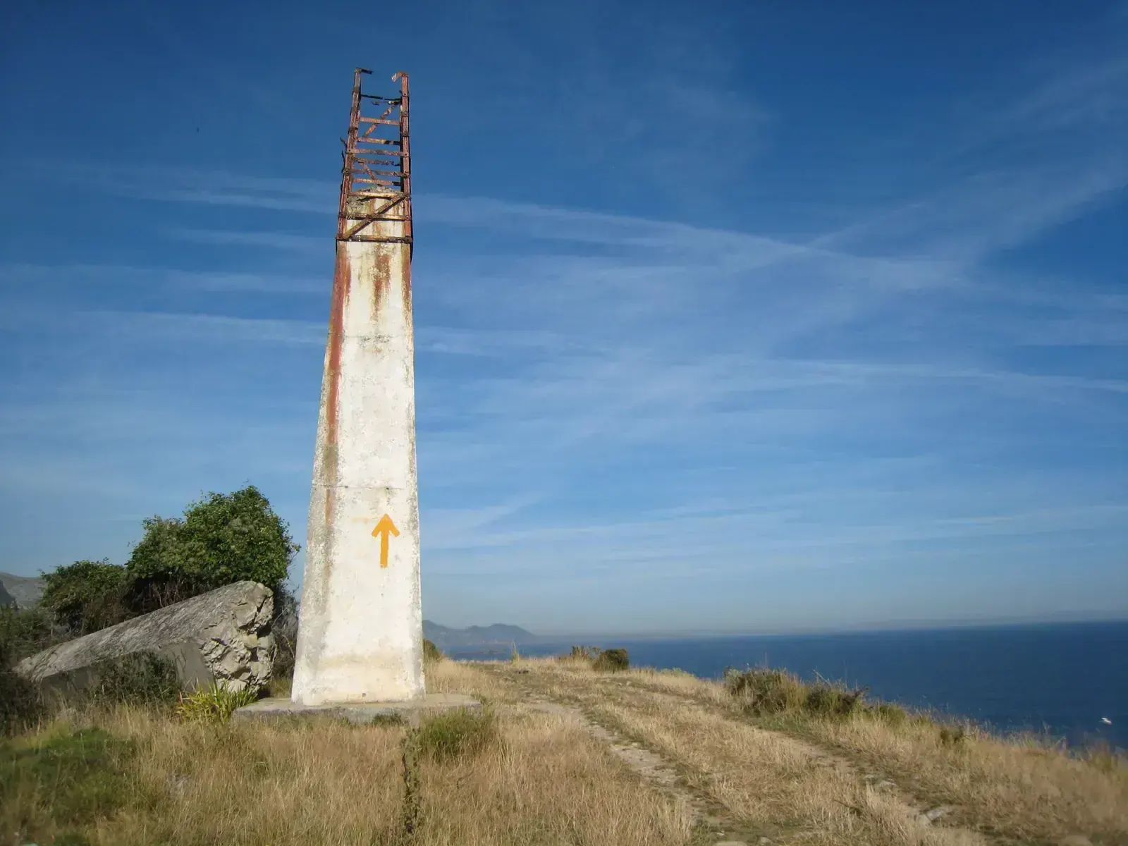
- High point
- 708 m · The hills before Sobrado dos Monxes
- Duration
- 32–36 days
- Best months
- May–Sep
- Difficulty
- Hard, non-technical
- Guide
- Not required
For guidance only. Check details with your operator and the official sources listed at the end before you book.
Where to book and compare Camino del Norte trips
Booking sites · affiliate linksEach site lists trips from several operators. Compare dates, group sizes, what is included and reviews there; we don't rank operators.
We earn a commission if you book through these links, at no extra cost to you. Prices and availability are on each site.
On this page
Which route should you choose?
The Camino del Norte has been part of the UNESCO World Heritage site "Routes of Santiago de Compostela" since 2015, when the listing was extended from the Camino Francés to four routes of northern Spain. The Northern Way is far less walked than the Francés: Gronze gives 17,836 pilgrims on the Norte in 2017, its latest figure. For comparison, the Francés had about 242,000 Compostelas in 2025. Our sources give no 2025 figure for the Norte.
Each region feels different. The Basque Country has up to ten ridges of 300 m to 500 m, on green wooded paths that turn to mud in the rain, and excellent waymarking. Cantabria is much flatter but mostly on asphalt, often beside the N-634 road, and the arrows are sometimes unclear. Asturias mixes roads, tracks and trails with small climbs; in Cantabria and Asturias, eucalyptus is common and long stretches run inland, away from the coast. In Galicia the first two stages are the hardest climbs, and the route leaves the sea for good.
Water shapes the route. You cross the Pasaia inlet by motor launch on day 1, the bay between Laredo and Santoña by boat outside winter, and the Bay of Santander by ferry from Somo or on foot via Pedreña. You enter Galicia over the Ría del Eo on the walkway of the Puente de los Santos, a motorway bridge, into Ribadeo. At Villaviciosa an inland branch leaves for Oviedo, where the Camino Primitivo starts.
| Route | Days | Scenery | Crowds | Acclimatisation |
|---|---|---|---|---|
| The full route from Irún to Santiago itinerary belowAbout 821 km to 822 km on the coastal line through the Basque Country, Cantabria and Asturias, then inland across Galicia to Arzúa and the last two stages on the Camino Francés. Gronze splits it into 34 stages to Arzúa plus two to Santiago; other guides use 32 to 34 stages in all. Add rest days, and expect busy beach towns in July and August. | 32–36 | Excellent | Low | Very good |
| Irún to Oviedo, then the Camino PrimitivoThe same coast as far as Villaviciosa in Asturias, then two inland stages via Pola de Siero to Oviedo: 26 km and 17.3 km. That is about 493 km from Irún in 21 Gronze stages. In Oviedo the Camino Primitivo begins, so you can walk on to Santiago along it (see our Camino Primitivo page for its stages). From Oviedo you can also rejoin the coast at Avilés (29 km). | 21 | Excellent | Low | Very good |
| From Vilalba, enough for the CompostelaVilalba to Santiago is about 111 km via As Cruces or 119 km via Miraz, by our sum of Gronze's stage figures, which is enough for the Compostela. Five stages, or six if you break the long Baamonde to Sobrado dos Monxes day at Miraz. It passes the route's high point before Sobrado and joins the Camino Francés crowds at Arzúa. | 5–6 | Very good | Medium | Very good |
5-day The full route from Irún to Santiago itinerary at a glance
The itinerary below groups the full route by region. The Basque Country runs from Irún to Portugalete, about 166.5 km in 8 stages, through San Sebastián, Zarautz, Deba, Markina, Gernika and Bilbao. Day 1, Irún to San Sebastián, is 24.7 km with about 630 m of climbing and descent over Jaizkibel and Ulía, about seven and a quarter hours. Monte Arno, just under 500 m, is the high point of this section. From Bilbao you can follow the official line to Portugalete (19.2 km) or the shorter one along the ría (13 km).
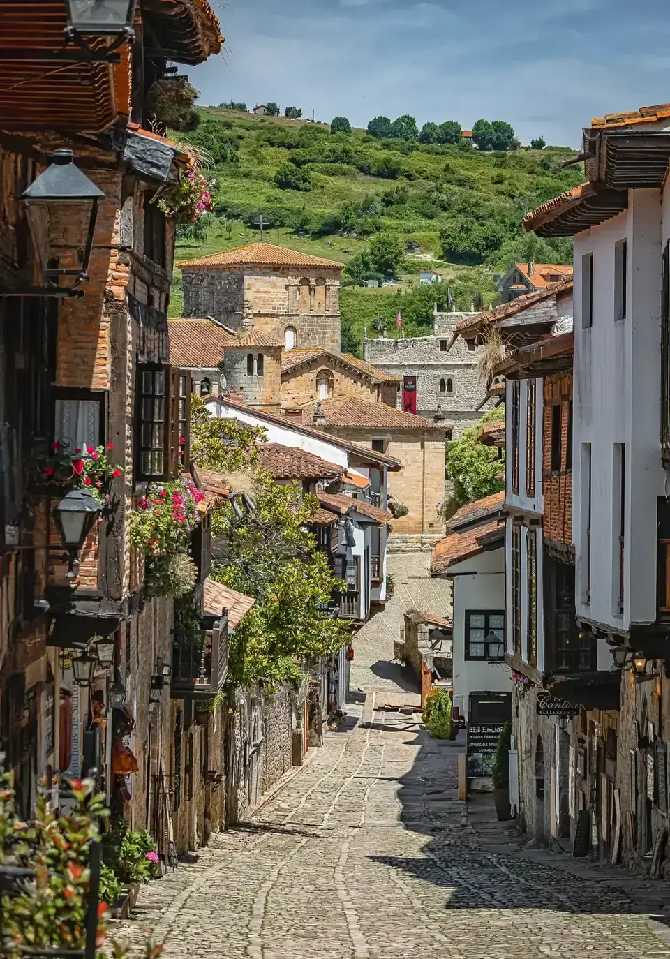
Cantabria, from Portugalete to Comillas, is about 165.1 km in 6 stages, via Castro Urdiales, Laredo, Güemes, Santander and Santillana del Mar. Several days are long: Portugalete to Castro Urdiales is 32.1 km and Santander to Santillana 36.3 km.
Asturias, from Comillas to Ribadeo, is the longest section: about 296.4 km in 13 stages, via Llanes, Ribadesella, Villaviciosa, Gijón, Avilés and Luarca. From La Caridad you reach Ribadeo via Tol (21.3 km) or Tapia de Casariego (22.4 km). The public albergue in Tol has been closed since 2023, so check beds before you choose.
Galicia, from Ribadeo to Arzúa, is about 154.2 km in 7 stages, via Mondoñedo, Abadín, Vilalba, Baamonde and Sobrado dos Monxes. Baamonde to Sobrado is 39.8 km via Miraz or 32 km via As Cruces, and the high point of the whole route, 708 m, comes in the hills before Sobrado. At Arzúa you join the Camino Francés for the last two stages, via O Pedrouzo (19.3 km and 19.7 km).
- Day 1 Irún Portugalete (end of the Basque Country section) night at 26 m
- Day 9 Comillas (end of the Cantabria section) night at 23 m
- Day 15 Ribadeo (end of the Asturias section, across the Eo into Galicia)
- Day 28 Arzúa (end of the Galicia section of the Norte) via The hills before Sobrado dos Monxes 708 mnight at 385 m
- Day 35 Santiago de Compostela (on the Camino Francés) night at 260 m
What it really costs
No permit is needed, only the credencial. The main costs are beds, food and getting to Irún. The Norte has fewer albergues than the Francés, and beach towns charge summer prices in July and August. Here is what to plan around, with 2026 figures.
Insurance that covers Camino del Norte
Take a travel policy with medical cover for the whole trip, especially if you hold no European health card (EHIC). Check that the policy covers long-distance walking and repatriation, and keep the emergency number of your insurer on your phone. In Spain call 112 for any emergency.
Staying connected in Spain
Spanish SIMs and eSIMs need your passport for registration. Buy one on arrival in Bilbao, San Sebastián or Irún, and download an offline map of the route before inland stretches.
Getting there and where to stay
Fly into Bilbao (BIO) or San Sebastián (EAS), then travel to Irún on the French border. Bilbao has non-stop flights from Istanbul and Madrid, which makes it the simpler arrival if you connect through either city. San Sebastián airport (EAS) is in Hondarribia, about 22 km from San Sebastián; check whether your connection serves it. At the end, Santiago has trains to Madrid.
Getting there by air
Bilbao or San Sebastián airport to Irún
A night in Irún before you start
Gear: rent or buy
This is a long walk between towns, not a mountain trek. Rain falls in every month on the north coast, and Basque paths turn muddy. Summer days are mild, around 22 °C to 24 °C on the coast. Carry a light pack, and send the rest ahead if you want.
- Walking shoes or light boots with good grip for wet, muddy paths and long asphalt stretchesBuy
- Waterproof jacket and a rain cover for the backpackBuy
- Backpack of about 30–40 litresRent or buy
- Light sleeping bag or liner for albergue dormsBuy
- Quick-dry clothes, a warm layer and sandals for the eveningBuy
- Water bottles for gaps of up to 17 km without servicesBuy
- Trekking poles for the Basque ridges and the first Galician climbsRent or buy
- Sun hat and sunscreen for the coast and the road sectionsBuy
- Phone with an offline map, some cash, and anything you need for your religious practice, such as a qibla app or a light prayer matBuy
Add a few days in Spain
A few places near the route are worth extra time, before, during or after the walk.
Praia das Catedrais
The Vizcaya Bridge in Portugalete
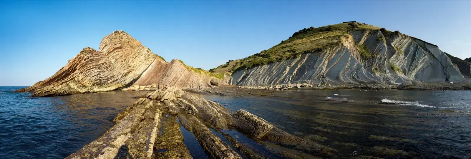
The flysch cliffs of Zumaia
Frequently asked questions
How hard is the Camino del Norte?
Hard, mainly for its length and its ups and downs: about 821 km to 822 km over 32–36 days. Gronze calls it one of the Iberian Caminos with the most climbing. The Basque Country has up to ten ridges of 300 m to 500 m, and some stages in Cantabria and Asturias pass 30 km. There is no technical ground, and the high point is only 708 m. Asphalt in Cantabria is hard on the feet.
Do I need a permit or a guide?
No permit and no guide. You carry a credencial, the pilgrim passport, and collect stamps in it. In Irún you get one at the albergue, even without sleeping there, or at the parish of San Gabriel y Santa Gema. Arrows are excellent in the Basque Country and sometimes unclear in Cantabria. The scallop-shell waymark changes at the Galician border. In Asturias the shell points the way its lines come together; in Galicia it points the way they spread out.
How do I get the Compostela?
Walk at least the last 100 km to the Cathedral on one route, with dated stamps at the start and end of each stage in that last 100 km: two a day. Starting in Vilalba covers this. If you start in France, at least 70 km must be in Spain. Register online, then collect it at the Pilgrim's Office, Rúa Carretas 33, open daily 10:00 to 19:00 except 25 December and 1 January. In busy periods, above all in 2027, you may not get it the same day. The Compostela is free and is given for religious or spiritual motives; anyone can ask for the certificate of distance (€3) instead or as well.
Where do I sleep, and do I need to book?
In albergues (dorms), pensions and hotels. Public albergues usually work first come, first served, and in Galicia the Xunta's albergues take no bookings; private ones do. Gronze counts 133 places with services between Irún and Arzúa, about one every 5.9 km, and some albergues open less outside summer. In 2026 the San Sebastián municipal albergue has closed for good, and the 40-bed Bilbao pilgrim albergue and several others are marked temporarily closed. Book ahead in San Sebastián, Santander, Santillana del Mar, Comillas, Llanes, Ribadesella and O Pedrouzo in summer, on weekends and on bank holidays. In the 2027 Holy Year, book earlier still.
What about food, dietary needs and faith on the Camino?
No albergue states that it serves halal food, and pork is common in Spanish cooking: chorizo, ham, lacón, and caldo gallego made with pork fat, so check before you order if you avoid pork or eat vegetarian. Fish, octopus, eggs (tortilla), vegetables, bread and cheese are easy to find, and the coast is good fish country. Ask at the counter or in writing for "sin cerdo" (no pork), whether beans or broth contain pork or chorizo, and whether wine is used. Vegan and kosher food is not something to expect in albergues and bars: bring what you need, and explain any allergy clearly, in writing if it helps.
Our sources list no mosque with a confirmed address on the route before Santiago. A Galician directory also lists an Islamic community in Lourenzá; ask locally. In Santiago, the Comunidad Islámica de Galicia is at Rúa Penedo 1. If you pray during the day, a qibla app and a light mat let you do so on the trail; churches are not prayer rooms.
Which languages do guides speak?
Albergue and hotel staff speak Spanish, plus Basque or Galician in those regions. If you book a tour with an operator, ask before you book about guides who speak other languages, such as Arabic, English or French.
Should I tip?
Tipping is not expected in Spain. Leaving small change or rounding up is welcome if the service was good. In a donativo albergue, give what you can for the bed.
Which visa do I need?
It depends on your passport: check the rules for your nationality with the Spanish consulate or its BLS visa centre where you live. Some passports need no visa for stays of up to 90 days in any 180; others need a Schengen visa (€90 for adults), applied for at that consulate or visa centre. Among Gulf passports, for example, UAE citizens need no visa, while Saudi, Qatari, Kuwaiti, Bahraini and Omani citizens do; they can get a five-year multiple-entry visa on their first application, and in October 2026 the EU began a review of visa-free travel for these five countries, but nothing has changed yet. Since April 2026 the Entry/Exit System takes fingerprints and a photo on your first entry. ETIAS, for visa-free visitors, is not running yet.
When is the best time to go?
May, June and September suit most walkers: long days, fewer rainy days than winter, and beds easier to find. July and August are the warmest months, with the fewest rainy days, but beach towns are busy and cost more. August is the only month when Spanish pilgrims outnumber foreign ones on this route. In winter some albergues close, the Laredo to Santoña boat stops, and the Guardia Civil advises against walking mountain sections from November to March without winter experience. Expect more pilgrims in the 2027 Holy Year, above all in Holy Week (21 to 28 March) and mid to late July.
Is it safe?
Yes, for most walkers, if you take care on the roads. Much of Cantabria follows roads, often the N-634, so walk facing traffic and wear something bright. The Jaizkibel ridge variant on day 1 is hard and lonely: take it only in good weather. The walkway on the Eo bridge into Ribadeo is narrow, between traffic and the drop, but fenced and railed. Carry water for gaps of up to 17 km without services. For emergencies call 112 (062 for the Guardia Civil); the AlertCops app has an SOS button and location sharing.
How is the Norte different from the Camino Francés?
It is hillier and much quieter, with the sea in view on many days. Some stretches have no services for up to 17 km, cities and beach towns cost more in summer, and you need boats or a bridge walkway at a few estuaries. The two routes meet at Arzúa for the last two stages.
Sources and last check
- Gronze: Camino del Norte stage table, distances and variants (checked 6 Nov 2026)
- Gronze: Camino del Norte information, length, high point, terrain, waymarking, service gaps, pilgrim numbers (checked 6 Nov 2026)
- Gronze: Irún to San Sebastián stage notes, Pasaia launch 2026 fare, Jaizkibel, credencial in Irún, Ondarreta albergue closed (checked 6 Nov 2026)
- Gronze: La Caridad to Ribadeo stage notes, Eo bridge walkway, waymark change in Galicia, Praia das Catedrais (checked 6 Nov 2026)
- Albergues Camino Santiago: Camino del Norte, 34 stages and 822 km, Arzúa to Santiago stages (checked 6 Nov 2026)
- Albergues Camino Santiago: Camino del Norte albergues in Galicia (updated 3 Nov 2026)
- Albergues Camino Santiago: Camino del Norte albergue guide, prices, summer demand, closures (modified 3 Nov 2026)
- Bookatrekking blog: Camino del Norte, 822 km in 32 stages (4 Oct 2024)
- UNESCO World Heritage Centre: Routes of Santiago de Compostela, 2015 extension (checked 6 Nov 2026)
- La Moncloa: UNESCO extension of the northern routes, Coastal Route 936 km (5 Jul 2015)
- WisePilgrim: Somo, ferry to Santander and low-tide alternative (pilgrim comments, checked 6 Nov 2026)
- WisePilgrim: Portugalete, altitude (checked 6 Nov 2026)
- WisePilgrim: Arzúa, altitude (checked 6 Nov 2026)
- Wikipedia: Portugalete, elevation 26 m (checked 6 Nov 2026)
- Wikipedia: Comillas, elevation (checked 6 Nov 2026)
- Wikipedia (via Wikiwand): Santiago de Compostela, elevation (checked 6 Nov 2026)
- AEMET: San Sebastián Igeldo climate normals 1981–2010 (checked 6 Nov 2026)
- AEMET: Santander airport climate normals 1981–2010 (checked 6 Nov 2026)
- AEMET: Santiago de Compostela airport climate normals 1981–2010 (checked 6 Nov 2026)
- Flightconnections: non-stop flights to Bilbao (checked 6 Nov 2026)
- Turkish Airlines: Bilbao–Istanbul flights (checked 6 Nov 2026)
- TravelDailyNews: Pegasus launches Istanbul–Bilbao (date not shown)
- Spain.info: San Sebastián airport, buses and taxi (checked 6 Nov 2026)
- Oarsoaldea tourism: how to get there, airports and trains (checked 6 Nov 2026)
- Wego: Gulf carriers to Madrid and Barcelona in 2026
- Que.es: Qatar Airways summer 2026 Spain schedule (21 Jun 2026)
- Kombo: Madrid–Santiago high-speed trains (checked 6 Nov 2026)
- Pilgrim's Office: credencial and office hours (checked 6 Nov 2026)
- Pilgrim's Office: Compostela rules (checked 6 Nov 2026)
- Pilgrim's Office: certificate of distance (checked 6 Nov 2026)
- Viaje Camino de Santiago: 2025 statistics by route (checked 6 Nov 2026)
- Viaje Camino de Santiago: what the Camino costs in 2026, albergues, rooms, daily budget (12 Jul 2026)
- Albergues Camino Santiago: Xunta public albergue price (25 Sep 2025, updated 27 Nov 2025)
- Albergues Camino Santiago: Xunta public albergue network rules (updated 20 Jun 2025)
- Albergues Camino Santiago: Xacobeo 2027 dates and booking (30 Oct 2026)
- Albergues Camino Santiago: Guardia Civil advice, November to March, AlertCops (5 Sep 2025)
- Correos: Paq Mochila conditions (checked 6 Nov 2026)
- Correos: Paq Mochila FAQ, Sarria–Santiago price (12 Mar 2026)
- IPC: Correos activates backpack transport for 2026 (13 Mar 2026)
- Felices Vacaciones: pilgrim menu price
- Wikipedia: list of mosques in Spain (partial, checked 6 Nov 2026)
- Páxinas Galegas: Islamic communities in Santiago de Compostela (checked 6 Nov 2026)
- Páxinas Galegas: Islamic communities in Galicia, incl. Lourenzá (checked 6 Nov 2026)
- La Presse: EU review of visa-free travel for five GCC countries (22 Oct 2026)
- The National: five-year Schengen visas for GCC citizens (13 May 2024)
- Embassy of Poland in Kuwait: Schengen visa fee from 11 June 2024
- Newland Chase: EES in force, ETIAS not yet running (9 Sep 2026)
- Selectra: prepaid SIM registration in Spain (updated 3 Nov 2026)