
Toubkal Circuit: six days around the massif via Lac d'Ifni, ending on the summit
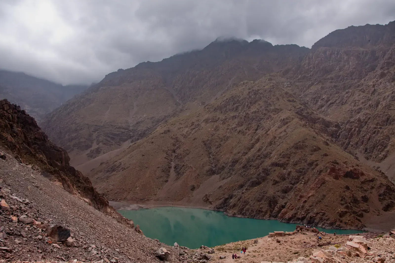
The Toubkal Circuit is a loop of about 68 km that starts and ends in Imlil and walks right round the Toubkal massif in the High Atlas. It crosses Tizi n'Tamatert, Tizi Likemt and Tizi n'Ououraine to the Tifnoute valley and camps at Lac d'Ifni. It then climbs Tizi n'Ouanoums (3,664 m) to the Toubkal refuges and finishes over Jbel Toubkal itself (4,167 m). Guidebooks give 4–6 days of walking; most plans use six stages. You sleep in village gîtes, in camps and at the refuges, with mules carrying the bags. A licensed guide is required in Toubkal National Park.
- High point
- 4,167 m · Jbel Toubkal
- Duration
- 4–7 days
- Best months
- Jun–Sep
- Difficulty
- Hard, non-technical
- Guide
- Required by park rules
For guidance only. Check details with your operator and the official sources listed at the end before you book.
Where to book and compare Toubkal Circuit trips
Booking sites · affiliate linksEach site lists trips from several operators. Compare dates, group sizes, what is included and reviews there; we don't rank operators.
We earn a commission if you book through these links, at no extra cost to you. Prices and availability are on each site.
On this page
Which route should you choose?
The circuit walks round the Toubkal massif, so most of it is on the quieter east and south sides, away from the standard summit path. Guidebooks give about 68 km to 69 km; one independent guide measures 60 km without the summit and 72 km with it. Expect four passes between about 2,280 m and 3,664 m, plus the summit at 4,167 m, and a total of almost 5,900 m of ascent. The 2–3 days ascent of Jbel Toubkal from Imlil has its own page; the circuit ends on the same summit after five days of walking.
The loop can be walked either way, but most plans go east first, to Tacheddirt, and keep the summit for last. That order is good for acclimatisation: you cross the high passes and drop back to valley villages before you sleep at the refuges at 3,207 m. The shorter western round via Tizi Mzik and the Azzaden valley and the one-way start from Amsouzart are listed below.

| Route | Days | Scenery | Crowds | Acclimatisation |
|---|---|---|---|---|
| Classic loop from Imlil via Lac d'Ifni itinerary belowAbout 68 km in six stages (Cicerone, 2025), or 69 km with about 5,858 m of ascent (Gestalten, 2024). Imlil, Tacheddirt, Tizi Likemt, Azib Likemt, Amsouzart, Lac d'Ifni, Tizi n'Ouanoums, the Toubkal refuges, the summit and back to Imlil. The east and south sides are quiet; from the refuges you join the busy summit route. A seventh day can be a second night at the refuges, for rest before the summit. | 6–7 | Excellent | Medium | Very good |
| Western Toubkal round via Tizi Mzik and AzzadenA shorter loop on the west side: Imlil, Tizi Mzik (about 2,480 m), the Azzaden valley and Tizi Oussem, then over Tizi Aguelzim to the Toubkal refuges and the summit. Operators typically sell it as 3–5 days. Villages in the Azzaden valley were hit hard by the 2023 earthquake and many houses have been rebuilt; ask your operator about the current state of gîtes there. Some longer circuits join both sides, but we found no guidebook stage list for them. | 3–5 | Very good | Medium | Good |
| From Amsouzart (south side), for Agadir arrivalsA one-way route rather than a loop: Amsouzart, Lac d'Ifni, Tizi n'Ouanoums, the Toubkal refuges, the summit and down to Imlil. The Souss-Massa regional tourism body describes it as 2–3 days. Amsouzart is about 240 km and four and a half hours by road from Agadir, via Taroudant and Aoulouz, so it suits arrivals at Agadir airport. | 2–3 | Excellent | Medium | Good |
6-day Classic loop from Imlil via Lac d'Ifni itinerary at a glance
The itinerary below follows the stage sequence in Gestalten (2024); Cicerone (2025) also counts the loop in six stages. Day 1 crosses Tizi n'Tamatert to Tacheddirt, about 12 km from Imlil. Day 2 climbs Tizi Likemt, the highest pass on the east side, to a shepherds' camp about an hour below it. Day 3 crosses Tizi n'Ououraine and drops to Amsouzart, the largest village on the loop, in the Tifnoute valley. Day 4 is shorter: the regional tourism body times Amsouzart to Lac d'Ifni at two and a half hours, and you camp by the only lake in the massif.
Day 5 is the hardest, a steep path and a long scree slope up to Tizi n'Ouanoums (3,664 m) and down to the Toubkal refuges. Day 6 starts before dawn: about 2.5 to 3 hours up to the summit, back to the refuge, then five to six hours down past Sidi Chamharouch to Imlil. Operators typically plan six to seven hours of walking on most days.
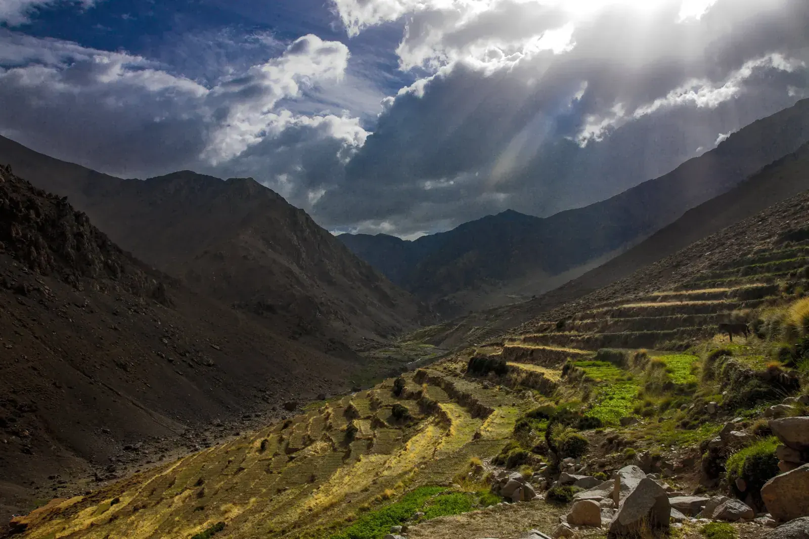
- Day 1 Imlil Tacheddirt via Tizi n'Tamatert 2,279 mnight at 2,314 m
- Day 2 Tacheddirt Azib Likemt (camp) via Tizi Likemt 3,555 m
- Day 3 Azib Likemt Amsouzart via Tizi n'Ououraine 3,113 m
- Day 4 Amsouzart Lac d'Ifni (camp) night at 2,300 m
- Day 5 Lac d'Ifni Toubkal refuges (Neltner and Les Mouflons) via Tizi n'Ouanoums 3,664 mnight at 3,207 m
- Day 6 Toubkal refuges, via the summit Imlil summit 4,167 mnight at 1,740 m
What it really costs
The circuit is usually walked with a guide, a muleteer and mules, often as a package, so the price depends on group size, how many nights are in gîtes or camps, and whether Marrakech transfers are included. Compare packages on the booking sites. The figures below are what to plan around if you arrange a guide in Imlil yourself, all approximate and in Moroccan dirhams (MAD), checked November 2026. Take cash from ATMs in Marrakech before you leave for the mountains. You may take at most 2,000 MAD in banknotes out of Morocco.
Insurance that covers Toubkal Circuit
Choose a policy that covers trekking up to at least 4,200 m and mountain rescue, including evacuation by helicopter, and check that it covers snow travel with crampons if you go outside summer. Rescue in the Atlas is carried out by the Gendarmerie, Civil Protection and the army.
Save the emergency numbers before you set off: 177 for the Gendarmerie Royale in the countryside and mountains, 15 for ambulance and fire, 19 for police in towns.
Staying connected in Morocco
eSIMs work in Morocco, and there are tourist SIM stands at the airports. Imlil has good 4G, but the signal drops on the way up and there is none at the Toubkal refuge.
Download offline maps before you leave Marrakech, carry a power bank, and agree with your guide how you will call for help in an emergency.
Getting there and where to stay
Fly into Marrakech Menara (RAK) for the usual start in Imlil, about 65 km south of the city. If you fly into Agadir (AGA), you can start on the south side at Amsouzart instead and finish in Imlil.
Getting there by air
Marrakech to Imlil
Agadir to Amsouzart
A night in Imlil
Gear: rent or buy
In summer nothing technical is needed, but the days are long, the passes are steep and stony, and nights at the camps and refuges are cold. When snow lies on the passes, you need crampons and an ice axe.
- Broken-in boots with ankle support for scree and stony pathsBuy
- Trekking poles for the long descents from each passRent or buy
- Warm jacket, hat and gloves: nights near freezing at 3,200 m even in summerRent or buy
- Warm sleeping bag for the camps at Azib Likemt and Lac d'IfniRent or buy
- Sun hat, sunglasses and high-factor sunscreenBuy
- Water bottles and purification tablets or a filterBuy
- Headlamp for the pre-dawn summit startBuy
- Crampons and ice axe, usually from December to March and sometimes in April and NovemberRent or buy
- Phone with offline maps and a power bankBuy
Add a few days in Morocco
The circuit is easy to lengthen or shorten, and the two gateway airports give you a choice of where to start.
A second night at the refuges
The western side via Azzaden
Start or finish via Agadir
Frequently asked questions
How hard is the Toubkal Circuit?
Hard. It covers about 68 km to 69 km in six stages, with four passes between about 2,280 m and 3,664 m, about 5,858 m of ascent and a summit at 4,167 m. Operators plan six or seven hours on most days, on steep, stony paths and scree, and the east and south sides are remote. In summer it needs no climbing skills, only fitness and some trekking experience. Watch for altitude sickness on the last two days, when you sleep at 3,207 m and reach 4,167 m.
Do I need a guide?
Yes. A licensed local mountain guide has been required in Toubkal National Park since early 2019. Police and gendarmerie posts at Aremd, Sidi Chamharouch and the refuge check guide credentials and record passports, walkers without a guide are turned back, and groups of six or more need two guides. Wild camping is not allowed along the Imlil to Toubkal trail. No official published text was found, so check the current rule with your guide or operator. Ask to see your guide's official card; in Imlil, the Bureau des Guides is on the central square.
How many days does the circuit take?
4–6 days of walking, according to the guidebooks; most plans use six stages. Add a day if you want a second night at the refuges before the summit, and a night in Marrakech or Imlil at each end. Operators typically sell it as six to eight days including transfers.
What about food, dietary needs and faith on the trek?
Meals in gîtes, refuges and camps are Moroccan home cooking: tagine, couscous, harira, bread and mint tea. If you eat halal, ask your guide or operator how meat is sourced, especially at the refuges. If you are vegetarian or vegan, or have an allergy or another dietary need, tell your operator when you book so the cook can plan for it. Kosher food is not something to expect on the trek; bring your own if you need it.
Morocco is a Muslim-majority country: expect village mosques and the call to prayer. If you pray, ask your guide to plan prayer stops and a clean, quiet place to pray, and to show you the qibla at camps. On summit day the pre-dawn start falls around Fajr, so plan it together. For any religious practice that needs time or space on the trek, agree it with your guide or operator before you start. Ramadan 2027 is expected from about 8 February to 9 March, in the snowy season; ask your operator how the team handles fasting days and meal times.
Which languages do guides speak?
Local guides speak Darija (Moroccan Arabic) and Tamazight. If you want a guide who is comfortable in another language, such as English, French or Spanish, ask when you book.
Should I tip the guide and the mule team?
Usually yes, but there is no official rate. One guidebook mentions a muleteer tip of up to 50 MAD per half-day. Agree tips for the guide, muleteer and cook with your operator in advance, and keep cash in dirhams for the last day.
Which visa do I need?
It depends on your passport. Passports on Morocco's visa-exempt list need no visa for a tourist visit; those of the UAE, Saudi Arabia, Qatar, Kuwait, Bahrain and Oman, for example, are on it. Check the length of stay with the Moroccan embassy. If your passport is not on the list, check whether you can apply for the e-visa on the official portal, acces-maroc.ma (770 MAD, or 1,100 MAD express, as of March 2024); UAE residents with an Emirates ID and at least 180 days' residency qualify for it.
When should I go?
June to September, when the passes are usually free of snow. July and August are very hot in the low valleys, and late August brings afternoon storms. April, May and October are possible but snow can cover the passes and you may need crampons. From December to March the circuit is a winter mountaineering trip.
Can I walk the circuit in winter or spring?
Only as a mountaineering trip. Crampons and an ice axe are usually needed from December to March, and sometimes in April and November; snow can occasionally block passes in May and June. Avalanches do occur: three people died in one in the Toubkal area in January 2026. Go with a guide equipped for winter conditions and check the forecast and snow cover before each pass.
Can I swim in Lac d'Ifni?
It is not advisable. Drownings have been reported in the lake, at its eastern end in particular. According to Wikipedia, a track reaches the shore from the Amsouzart side, so you may meet vehicles and day visitors at the camp. A local guesthouse blog (March 2025) describes a new stone path of about 5 km to the lake from the Andouss café at Imhilene, with mules available.
Can I start from Agadir?
Yes, from Amsouzart on the south side. It is about 240 km and four and a half hours by road from Agadir, via Taroudant and Aoulouz. From Amsouzart, the route over Lac d'Ifni and Tizi n'Ouanoums to the refuges and the summit takes 2–3 days, finishing in Imlil.
Are the villages open again after the 2023 earthquake?
Yes, trekking resumed within weeks. After the earthquake of 8 September 2023, the Imlil road reopened by 12 September, the Toubkal path within weeks, and the refuges were repaired and receiving climbers by December 2023. Housing reconstruction in Al Haouz was over 90% complete by September 2025, and no source reports a trail or refuge still closed. Some gîtes were damaged, and villages in the Azzaden and Tifnoute valleys were badly hit, so expect rebuilding and check the current state of gîtes with your operator.
Sources and last check
- Cicerone, Climbing Toubkal (2025): circuit stages, distance, days, guide rule (checked 6 Nov 2026)
- Cicerone info sheet: 6 stages, 68 km (checked 6 Nov 2026)
- Gestalten, Wanderlust Mediterranean (2024): distance, ascent, passes, stage sequence (checked 6 Nov 2026)
- The Hiking Life: circuit distances, direction, guide reports (checked 6 Nov 2026)
- Souss-Massa regional tourism body: Tizi n'Ouanoums, Lac d'Ifni, refuge, Agadir access (checked 6 Nov 2026)
- Souss-Massa regional tourism body: Lac d'Ifni from Amsouzart (checked 6 Nov 2026)
- Routard: Amsouzart, Lac d'Ifni altitude, gîtes (checked 6 Nov 2026)
- SummitPost: Tizi Likemt, Tacheddirt, Tizi n'Tamatert (checked 6 Nov 2026)
- Wikipedia (Oct 2023 snapshot): Tacheddirt altitude (checked 6 Nov 2026)
- Wikipedia: Lake Ifni, altitude, track to the shore, drownings (checked 6 Nov 2026)
- Le Jardin aux Étoiles (guesthouse blog, March 2025): new stone path to Lake Ifni from Imhilene (checked 6 Nov 2026)
- Hikr: Tizi n'Mzik altitude (checked 6 Nov 2026)
- Wikiloc: Tizi Mzik waypoint altitude (checked 6 Nov 2026)
- Wikipedia: Toubkal summit, refuges, summit-day times (checked 6 Nov 2026)
- SummitPost: Toubkal normal route, summer temperatures at the refuge and summit (checked 6 Nov 2026)
- FATMAP: refuge to summit times and distance (checked 6 Nov 2026)
- refuges.info: Refuge du Toubkal, altitude and facilities (checked 6 Nov 2026)
- Trailblazer: guide rule, checkpoints, camping, Lac d'Ifni drownings (checked 6 Nov 2026)
- Yabiladi: security measures around Imlil, December 2018 (checked 6 Nov 2026)
- UKHillwalking: Toubkal guide rule, altitude, seasons (checked 6 Nov 2026)
- Moroccan mountain guide licence conditions (checked 6 Nov 2026)
- Frommers: Western High Atlas, transport, guide and mule rates, Bureau des Guides (checked 6 Nov 2026)
- Much Better Adventures magazine: winter on Toubkal, two refuge nights (operator, checklist only) (checked 6 Nov 2026)
- Much Better Adventures magazine: crampon months by season (operator, checklist only) (checked 6 Nov 2026)
- Hespress: fatal avalanche in the Toubkal area, January 2026 (checked 6 Nov 2026)
- Hespress: climbing resumes on Toubkal after the 2023 earthquake (checked 6 Nov 2026)
- Kasbah du Toubkal: Imlil road and path reopening, September 2023 (operator, checklist only) (checked 6 Nov 2026)
- Yabiladi: rural tourism and gîtes in Al Haouz, September 2024 (checked 6 Nov 2026)
- Yabiladi: Al Haouz reconstruction progress, September 2025 (checked 6 Nov 2026)
- Medias24: Tifnoute valley after the earthquake, September 2023 (checked 6 Nov 2026)
- Alajode: Azzaden valley rebuilding, February 2026 (checked 6 Nov 2026)
- MarocMama: mobile coverage in Imlil and at the refuge (checked 6 Nov 2026)
- Emergency numbers 15, 19, 177 (checked 6 Nov 2026)
- Bladi: visa-exempt countries for Morocco (checked 6 Nov 2026)
- Gulf News: Morocco e-visa fees and eligibility, March 2024 (checked 6 Nov 2026)
- Bladi: dirham banknote export limit, October 2026 (checked 6 Nov 2026)
- AACO: Royal Air Maroc resumes Doha and Dubai, July 2026 (checked 6 Nov 2026)
- FlightConnections: nonstop flights from Casablanca (checked 6 Nov 2026)
- The National: Ramadan 2027 expected dates (checked 6 Nov 2026)
- US State Department: Morocco travel advisory (checked 6 Nov 2026)
- UK FCDO: Morocco safety and security, including hiking (checked 6 Nov 2026)