
Annapurna Circuit trek: routes, permits, costs and what to expect
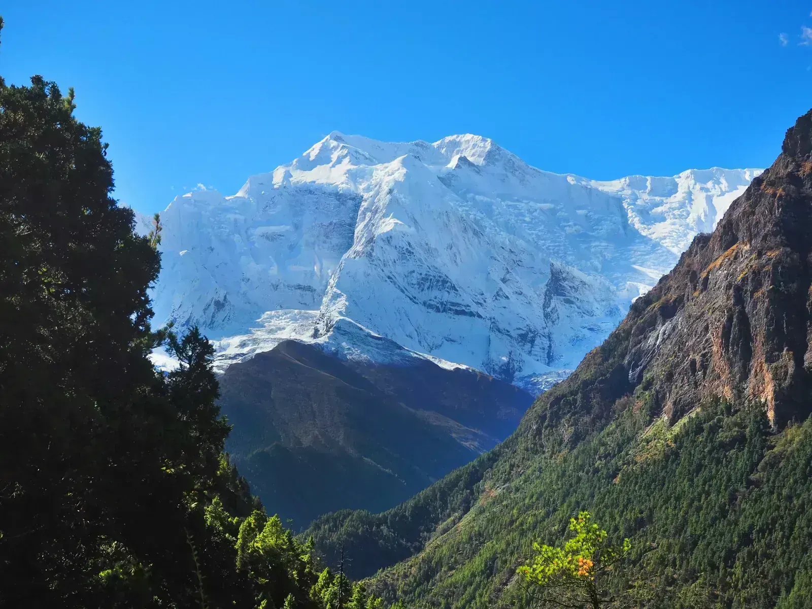
The long crossing of the Annapurna region: up the Marsyangdi valley from Besisahar to the village of Manang, over the Thorong La pass at 5,416 m, then down to the temple at Muktinath and the Kali Gandaki valley. Roads now reach Manang on one side and Muktinath on the other, so most trekkers drive part of the way. No climbing skills are needed, but the pass day is long and cold, and the altitude is the real test. Here is what to expect, from the bus to Besisahar to the road out from Jomsom.
- High point
- 5,416 m · Thorong La
- Duration
- 13–15 days
- Best months
- Apr–May, Oct–Nov
- Difficulty
- Hard, non-technical
- Guide
- Required by park rules
- Typical cost
- $500–2,500estimate per person
For guidance only. Check details with your operator and the official sources listed at the end before you book.
Where to book and compare Annapurna Circuit trips
Booking sites · affiliate linksEach site lists trips from several operators. Compare dates, group sizes, what is included and reviews there; we don't rank operators.
We earn a commission if you book through these links, at no extra cost to you. Prices and availability are on each site.
On this page
Which route should you choose?
Almost everyone walks the circuit anticlockwise: up the Marsyangdi valley to Manang, over Thorong La, then down to Muktinath and the Kali Gandaki. That way the altitude rises slowly, and on the pass day you climb about 900 m from Thorong Phedi instead of about 1,650 m from Muktinath. The variants mostly change how much of the road you drive, and whether you add Tilicho Lake.
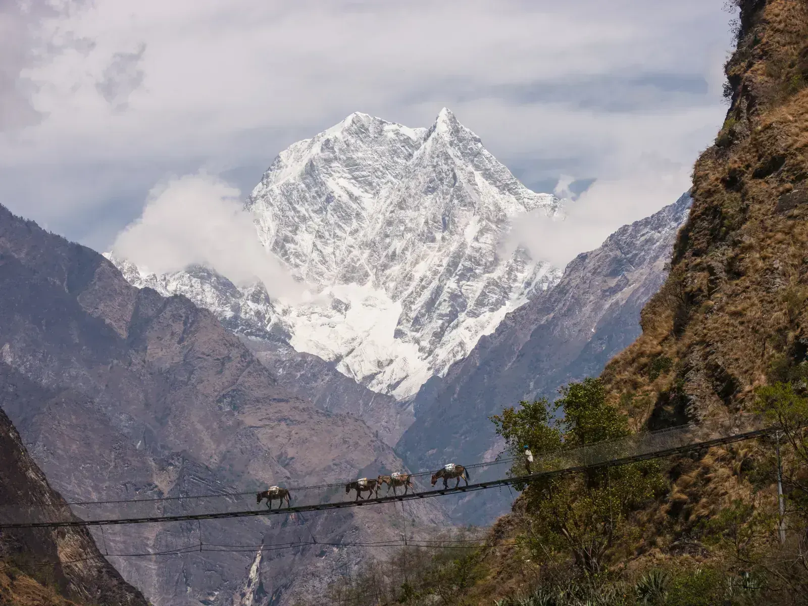
Roads now reach Manang and Muktinath, and they have changed much of the original route, which once took about three weeks. The pass itself has no motor road. The NATT side trails avoid the road on long stretches, such as the east bank of the Marsyangdi from Tal to Dharapani and the high route from Upper Pisang through Ghyaru to Ngawal. Expect dust and traffic where you do walk on the road.
| Route | Days | Scenery | Crowds | Acclimatisation |
|---|---|---|---|---|
| Classic anticlockwise, jeep to Dharapani or Chame itinerary belowBus or jeep to Besisahar, jeep on to Dharapani or Chame, then on foot via Manang, with an acclimatisation day there, over Thorong La to Muktinath, and out by road from Muktinath or Jomsom to Pokhara. Days counted from Kathmandu, with spare days for road delays. | 13–15 | Excellent | High | Very good |
| With Tilicho LakeAdds two or three days from Manang to Tilicho Base Camp (about 4,150 m) and the lake at about 4,920 m, then rejoins the main trail at Yak Kharka or Letdar before the pass. The trail crosses a scree and landslide zone where you should keep moving. | 15–18 | Excellent | Medium | Very good |
| Short version, jeep to Chame or ManangA jeep up the valley to Chame or all the way to Manang, then the pass and the road out from Muktinath. Driving straight to Manang at 3,519 m skips the slow climb that prepares the body for the pass, so plan at least two nights there. Days counted from Kathmandu. | 9–11 | Very good | High | Weaker |
| Full walk-in on the NATT trailsOn foot from Besisahar or Bhulbhule on the Natural Annapurna Trekking Trails, side paths marked in blue and red that avoid much of the road, including the high route via Upper Pisang, Ghyaru and Ngawal. Many trekkers still finish at Jomsom, where the road-free options below are weaker. Days counted from Kathmandu. | 17–21 | Excellent | Low | Very good |
11-day Classic anticlockwise, jeep to Dharapani or Chame itinerary at a glance
The itinerary below is the common 11 days from Kathmandu to Jomsom, with a jeep from Besisahar to Dharapani and two nights in Manang so the body can adjust. Day 10 is the long one: leave Thorong Phedi before dawn, often around 3 or 4 am, reach the pass in the morning before the wind rises, then descend about 1,600 m to Muktinath, 7–10 hours in all. Day 11 goes down to Jomsom by jeep or on foot via Kagbeni; day 12 is a long drive by road to Pokhara and day 13 the return to Kathmandu.
Short on time? Drive to Manang and walk from there: Gangapurna Lake (about 3,540 m) is about 30 minutes from the village, and the Ice Lake (about 4,600 m) is a day hike of 6–8 hours return via Braga, with about 1,050 m of climbing. Arriving by jeep at 3,519 m gives the body no time to adjust, so keep the first day gentle. With only a day or two in Pokhara, the Sarangkot viewpoint (about 1,600 m) has a sunrise tower facing Dhaulagiri, Annapurna and Manaslu.
- Day 1 Kathmandu (bus or jeep) Besisahar night at 760 m
- Day 2 Besisahar (jeep) Dharapani night at 1,860 m
- Day 3 Chame night at 2,670 m
- Day 4 Upper Pisang night at 3,300 m
- Day 5 Ngawal night at 3,660 m
- Day 6 Manang night at 3,519 m
- Day 7 Manang (acclimatisation day) night at 3,519 m
- Day 8 Yak Kharka night at 4,018 m
- Day 9 Thorong Phedi night at 4,540 m
- Day 10 Muktinath (Ranipauwa) via Thorong La 5,416 mnight at 3,700 m
- Day 11 Muktinath (jeep or on foot via Kagbeni) Jomsom night at 2,743 m
What it really costs
Package prices depend on group size, lodge level, how much of the road you drive and how you leave Jomsom, so compare them on the booking sites. These are the costs to plan around if you build the trek yourself or check what a package includes.
Insurance that covers Annapurna Circuit
You will cross Thorong La at 5,416 m, so check that your policy covers trekking to at least 5,500 m. It must include helicopter evacuation: after the September 2026 storm, ill trekkers and those with visa deadlines were flown out of Manang by helicopter.
The Himalayan Rescue Association has run an aid post in Manang since the 1980s, usually in spring and autumn, with an afternoon talk on altitude sickness; check that it is open when you go. There are health posts at Dharapani, Chame, Manang and Muktinath, and a district hospital in Jomsom. Keep your policy number and the insurer's emergency line on paper as well as on your phone.
Staying connected in Nepal
An eSIM installed before you fly works on landing in Nepal; local SIM cards are sold at Kathmandu airport with your passport and a photo. On the trail, mobile signal comes and goes in the deep valleys: ask your operator which network works best on the route.
Most lodges sell wifi, usually for a few dollars. Download offline maps before Besisahar, and carry a power bank, since charging is paid by the device higher up.
Getting there and where to stay
Fly into Tribhuvan International Airport (KTM) in Kathmandu, then drive about 175 km to Besisahar: 5–8 hours by bus from Gongabu or Kalanki, or by private jeep. Via Dubai there is now another way in: flydubai flies daily from Dubai to Pokhara International Airport (PHH), the town where the trek ends. At the end, plan to leave Jomsom by road via Beni to Pokhara.
Getting there by air
Leaving Jomsom
Spare nights in Pokhara
Gear: rent or buy
Nothing technical, but a cold pass: in November nights on Thorong La fall to about −10 °C, the climb starts in the dark, and bedrooms are not heated. A warm sleeping bag and a down jacket matter more than anything else, and both can be rented in Kathmandu.
- Broken-in trekking boots with ankle supportBuy
- Sleeping bag rated to about −15 °CRent
- Down jacketRent
- Fleece or synthetic mid-layers and thermal base layersRent or buy
- Warm hat, gloves and liner glovesBuy
- Sunglasses with high UV protection and sunscreenBuy
- Trekking poles for the long descent from the passRent or buy
- Water bottles and purification tablets or a filterBuy
- Headlamp for the pre-dawn start on Thorong LaBuy
- Buff or dust mask for the road sectionsBuy
Add a few days in Nepal
The trek ends near Pokhara, on Phewa Lake below the Annapurnas, and Kathmandu Valley has seven monument zones on the UNESCO World Heritage list, all within an hour of the city centre; spare days at either end are a good time to see them.
Sarangkot sunrise
Boudhanath Stupa
Bhaktapur Durbar Square
Frequently asked questions
How hard is the Annapurna Circuit?
It is a long walk at high altitude, not a climb. The classic route is 8 or 9 days on foot from Dharapani to Muktinath or Jomsom, with nights up to about 4,540 m at Thorong Phedi; the full distance is about 130 km to 230 km, depending on how much of the road you drive. The pass day is the hard one, 7–10 hours with about 900 m up and 1,600 m down. There are no technical sections, but snow can make the pass difficult.
Is the trek open after the September 2026 storm?
As of early November 2026, yes. Rain and snow from 24 to 27 September 2026 closed Thorong La for about two weeks and cut the road at Chame. The pass reopened on 5 October once the snow was cleared, and by 29 October a temporary crossing at Chame's bridge let vehicles through and roads reached Upper Manang and Muktinath (Kathmandu Post). Repairs are temporary: check road and pass conditions with ACAP or your operator before you go.
Do I need a guide?
Since April 2023, a national rule says foreign trekkers must have a licensed guide. On 27 September 2026, after the floods, ACAP urged trekkers to use licensed guides on its routes except short ones, naming Jomsom, Muktinath and Ghandruk as places that do not need one. Enforcement on the circuit varies, and ACAP permits can be bought without an agency. Rules in Nepal change: check the current position with ACAP or your operator before you go.
Which permits do I need?
The Annapurna Conservation Area (ACAP) permit: NPR 3,000 for foreigners, tax included, NPR 1,000 for SAARC nationals, free for children under 10. Buy it in Kathmandu, Pokhara or online before you go, because it costs double at a check-post, and show it at the check-posts on the way, such as Dharapani. Ask your operator whether a TIMS card is currently required; reports differ.
Is Thorong La safe, and can I get altitude sickness?
Altitude is the main risk. Take the acclimatisation day in Manang, climb slowly to Thorong Phedi, and tell your guide about headaches, nausea or breathlessness; if symptoms get worse, go down, not over the pass. Start before dawn, because strong wind usually rises a few hours after sunrise. Weather is the other risk: in October 2014 a blizzard linked to the remnants of Cyclone Hudhud killed at least 43 people in the region, at least 21 of them trekkers. If lodges or your guide say wait, wait. Read our altitude sickness guide before you go.
What about food, dietary needs and faith on the trek?
Vegetarian dal bhat (rice, lentils and vegetables), noodles, eggs and Tibetan bread are on every menu, so eating vegetarian is easy. No halal food is confirmed anywhere on the trail, Manang, Muktinath and Jomsom included. If you need halal or vegan food or have an allergy, tell your operator when you book and ask about bringing your own food. Kosher food is not something to expect on the trail; bring your own if you need it. Pokhara has halal-listed restaurants around Lakeside; Kathmandu has halal restaurants.
If you pray, use your room or a quiet corner and agree times with your guide. On the pass day you leave around 3 to 5 am, before Fajr (the dawn prayer). There are no mosques on the route; Pokhara has the Aqsa Masjid near Miya Patan and Kathmandu the Nepali Jame Masjid near the clock tower. Water for wudu or washing is ice-cold high up. Muktinath is sacred to Hindus and Buddhists: dress and behave modestly at the temple.
Which languages do guides speak?
Most guides speak English and Nepali. If you need another language, such as Arabic, French or Spanish, ask operators before booking whether they can assign a guide who speaks it. A private trek gives you the most say in who walks with you.
Should I tip the guide and porter?
Yes, tipping at the end of the trek is customary in Nepal and a real part of guides' and porters' income. Common guidance is about 10% of the trek cost, or roughly $100–150 each for a guide or porter on a trek of 15 to 18 days, in cash. Ask your operator what is usual for your group.
Which visa do I need?
It depends on your passport: check the current rules with Nepal's Department of Immigration before you fly. A tourist visa on arrival at Kathmandu airport costs $30 for 15 days, $50 for 30 days or $125 for 90 days. Citizens of Saudi Arabia, the UAE, Qatar, Kuwait, Bahrain and Oman, for example, can get one; holders of some other passports, such as Iraqi, Palestinian or Afghan, must apply at an embassy first. With spare days for road delays, most people need 30 days. If you fly into Pokhara, check before you fly that visas on arrival are issued there.
How do I get back from Jomsom or Muktinath?
By road for now. Tara Air and Summit Air suspended Jomsom–Pokhara flights in mid-October 2026, with no restart announced by early November, so plan on a jeep or bus from Muktinath or Jomsom down to Beni, about 76 km from Jomsom, and on to Pokhara. If flights have resumed, they run only in the morning and leave from Pokhara's old domestic airport, not PHH; check before you book.
When is the best time to go?
October and November, then April and May. Autumn usually brings the clearest skies, but snowstorms can close the pass even then, as in late October 2025 and late September 2026. The monsoon, from June to September, brings landslides on the roads, and in winter the pass is often snowbound.
Sources and last check
- Kathmandu Post: Annapurna Circuit arrivals rebound after floods (October 2026)
- Kantipur: the Annapurna Circuit reopens after two weeks (October 2026)
- Onlinekhabar: ACAP urges trekkers to hire guides (September 2026)
- Kathmandu Post: the 2023 guide rule for foreign trekkers
- NTNC: ACAP entry permit portal
- Kantipur: Pokhara–Jomsom flights suspended (October 2026)
- Himalayan Times: flydubai opens Pokhara–Dubai bookings to October 2027 (October 2026)
- Embassy of Nepal: visa information and fees
- Wikipedia: Thorong La
- Wikipedia: Annapurna Circuit
- Himalayan Rescue Association: Manang aid post
- CDC Yellow Book: high-altitude travel and altitude illness